We reached the southern tip of Bonaire, then looped around headed north along the eastern shore. Next stop: Sorobon Beach located on the shallow, protected waters of Lac Bay. From all the people here, this is obviously the place to go for beaching, snorkeling, wind surfing, and bird watching.
Sorobon Beach on Lac Bay, Bonaire
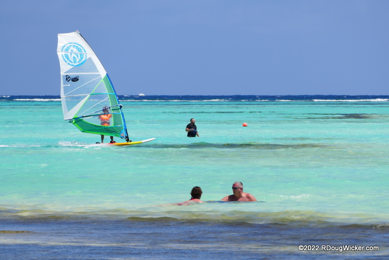
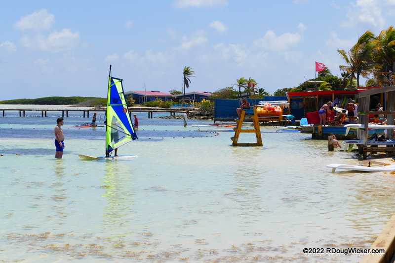
There are several wind surfing schools here, and wind surfers zipped to-and-fro among the many swimmers.
Wind Surfers and Beachgoers Sharing the Space
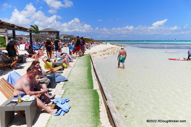
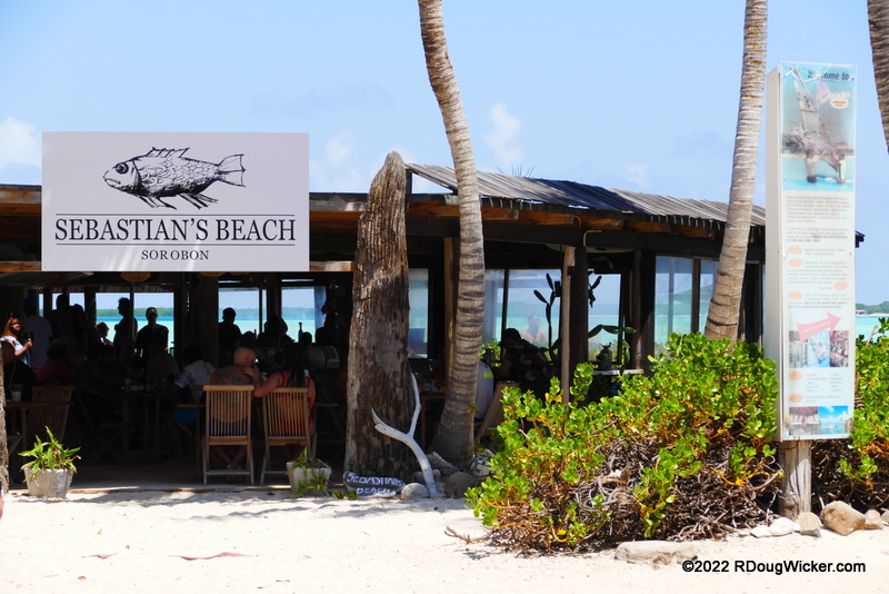
Yes, there are places to imbibe and eat, as well:
Sebastian’s Beach
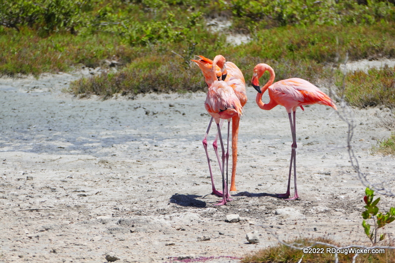
Oh, did I mention the bird watching in this area? Take a gander:
Nearby flamingos
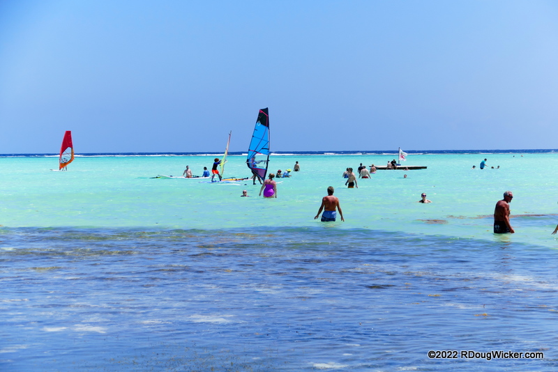
But, let’s face it, most people are here for fun in the sun:
Sorobon Beach
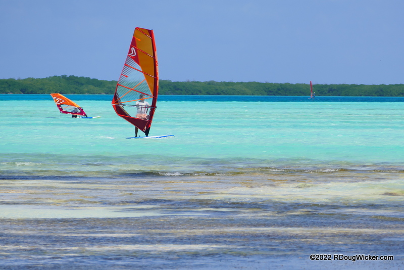
Shallow waters and steady breezes; perfect for wind surfing
From Sorobon Beach we cut back across the island to the west side and returned to Kralendijk. Here we asked to be dropped off south of the cruise port so that we could take in sights not yet seen earlier that day:
After our foot patrol of Kralendijk Ursula and I struck up a conversation with a local, who recommended the young lady you see pictured above for a tour of the southern portion of Bonaire. According to the local, the south is much more interesting than the north. So we met up with our tour guide and shared her minibus with a New York family who had recently immigrated from Haiti. Our first stop, just north of these interesting rentals at the Courtyard by Marriott Bonaire Dive Resort:
Rentals at Courtyard by Marriott Bonaire Dive Resort
Next stop:Bachelor’s Beach, about three miles/five kilometers south of Kralendijk for some photos of that gorgeous, blue Caribbean water and white sand beach:
Bachelor’s Beach looking north toward Kralendijk
View south on Bachelor’s Beach
Farther south we came across an interesting area used to harvest sea salt. This is the Cargill Salt Ponds:
Cargill Salt “Pyramids”
In this next photograph, although it doesn’t show very well, you can just make out the pink hues in the ponding area to the right:
Cargill’s pink ponds
Directly across from the ponds is the Salt Pier:
Salt Pier — used to load salt onto ships
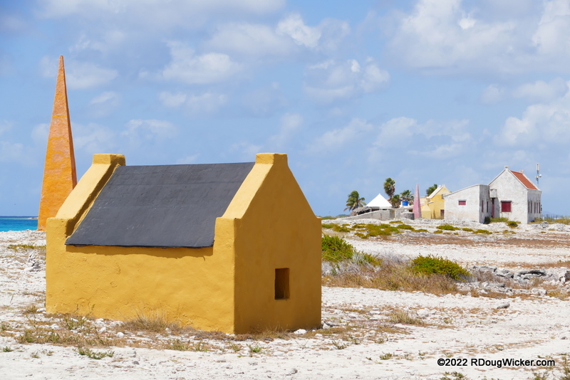
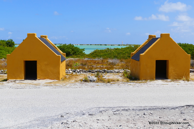
About 1.8 miles/2.9 kilometers south of the Salt Pier lies a tragic reminder from the Caribbean’s past dating from 1850. The stone huts below aren’t tall enough inside to allow one to stand upright. The small doorways (see below) require you to crawl to gain entrance. Yet these structures housed up to six slaves, who worked the salt ponds to the north.
Slave Huts on Bonaire
The obelisk pictured below is one of four that were constructed to guide ships. They were color coded — red, white, blue, and orange. Ship captains would view a colored flag flying from the fort in Kralendijk, then sail to the correspondingly colored obelisk to pick up their salt load.
Slave hut and navigational obelisk
A final look today of these sad reminders of both Caribbean and U.S. history:
The “B” in the ABC Islands stands for Bonaire, and we’re going to look at this destination over the next two weeks. That’s because, unlike “A” (Aruba) we did a lot more than just shopping. We went on a brief foot tour of the capital city Kralendijk, followed by a minibus tour that would take us to the southern end of this Caribbean Netherlands island in the Leeward Antilles.
Historical Kralendijk Walking Tour map conveniently located at the port
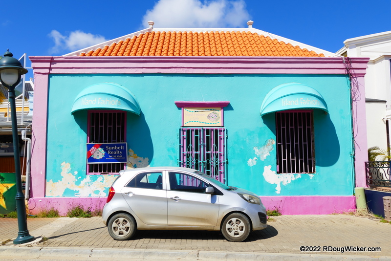
Upon arrival Ursula and I picked up a paper copy of the walking tour map you see above and set out on foot. The more historical foot-tour stuff I’ll show next week. Today I’m going to concentrate on the unique, colorful buildings we saw along the way starting with this charming little shop on Kaya Grandi (Main Stree):
Colorful retail shop for rent on Kaya Grandi (Main Street)
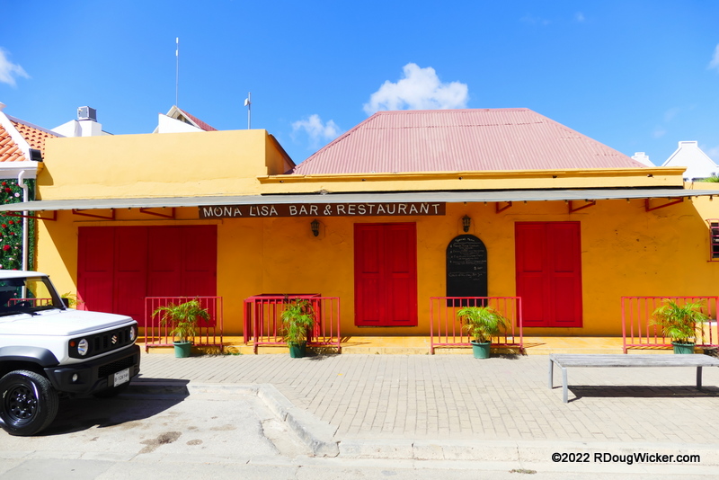
The storefronts along Kaya Grandi are awash in bright color. Take for instance the Mona Lisa Bar & Restaurant:
Mona Lisa in yellows and reds
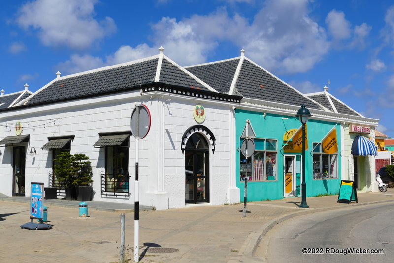
But that image doesn’t give you the full impact until you get a line up a whole row of brightly colored buildings along this main shopping area:
Kaya Grandi near Kaya Isla Riba
Continuing our trek northward along Kaya Grandi:
Kaya Grandi
Beyond Kaya L.D. Gerharts the colorful building begin to peter out, but keep trekking:
Kaya Grandi at Kaya L.D. Gerhardts
You’ll still find some interesting photo subjects if you do:
Tiki and Company bar
It was beyond the Tiki bar pictured above that we stumbled upon a rather colorful car rental agency, Rento Fun:
Rento Fun
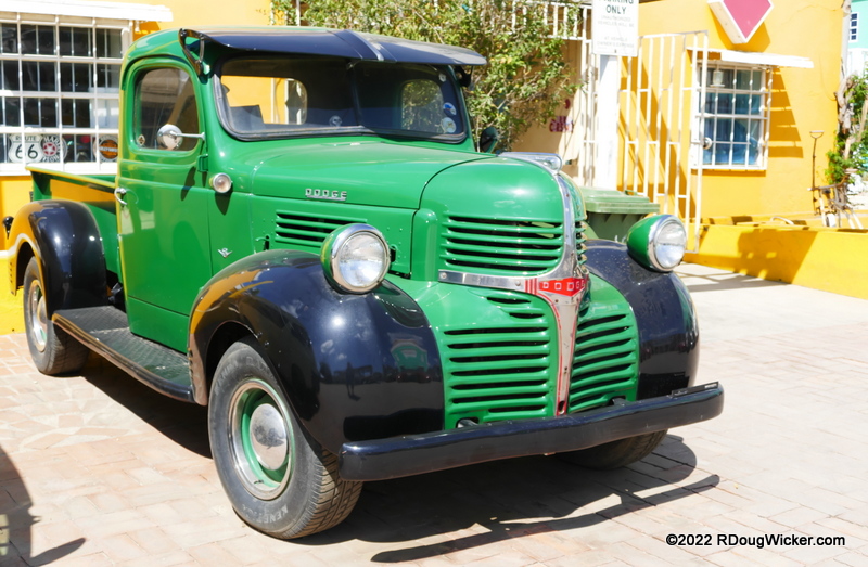
Yep. Those are Land Rovers for rent. The chartreuse one is a particularly nice touch. But that’s not what really caught my eye. What drew my interest was this circa 1945 Dodge truck:
Dodge truck, circa mid-1940s
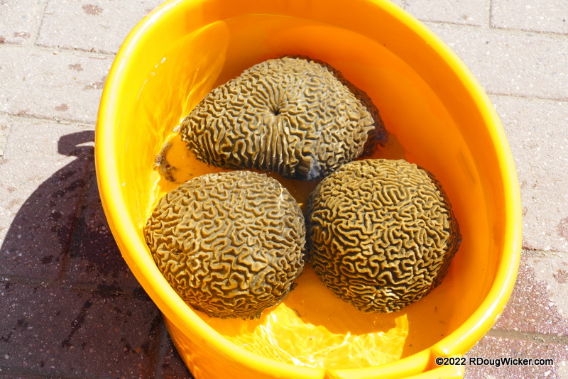
Much beyond here interest waned, and we headed west for the parallel Kaya J.N.E. Craane for a look along the water’s edge. Under construction was a new pier, and efforts were underway to relocate coral:
Brain coral being relocated
On Wednesday I’ll show you our trek south on a guided tour we picked up near the cruise port. Until then:








 Decisions — Murder in Paradise
 The Globe — Murder in Luxury
 R. Doug Wicker — Author