

After our foot patrol of Kralendijk Ursula and I struck up a conversation with a local, who recommended the young lady you see pictured above for a tour of the southern portion of Bonaire. According to the local, the south is much more interesting than the north. So we met up with our tour guide and shared her minibus with a New York family who had recently immigrated from Haiti. Our first stop, just north of these interesting rentals at the Courtyard by Marriott Bonaire Dive Resort:

Next stop: Bachelor’s Beach, about three miles/five kilometers south of Kralendijk for some photos of that gorgeous, blue Caribbean water and white sand beach:


Farther south we came across an interesting area used to harvest sea salt. This is the Cargill Salt Ponds:

In this next photograph, although it doesn’t show very well, you can just make out the pink hues in the ponding area to the right:

Directly across from the ponds is the Salt Pier:

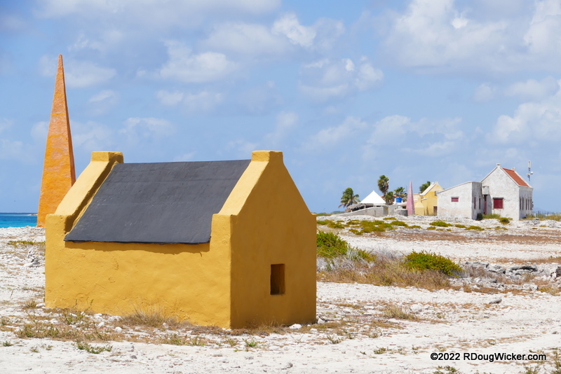
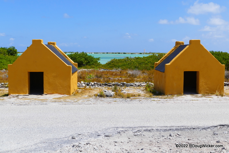
About 1.8 miles/2.9 kilometers south of the Salt Pier lies a tragic reminder from the Caribbean’s past dating from 1850. The stone huts below aren’t tall enough inside to allow one to stand upright. The small doorways (see below) require you to crawl to gain entrance. Yet these structures housed up to six slaves, who worked the salt ponds to the north.

The obelisk pictured below is one of four that were constructed to guide ships. They were color coded — red, white, blue, and orange. Ship captains would view a colored flag flying from the fort in Kralendijk, then sail to the correspondingly colored obelisk to pick up their salt load.
A final look today of these sad reminders of both Caribbean and U.S. history:
Слава Україні! (Slava Ukraini!)
 Decisions — Murder in Paradise
 The Globe — Murder in Luxury