
Guayaquil Malecón Simón Bolívar
Yes, we sometimes travel by land rather than cruise ship. Ursula and I did so in February, 2016, for a comprehensive tour of Ecuador. We flew into Guayaquil, Ecuador, one day before we were to meet up with our tour group, which meant we had an entire day in Guayaquil to explore on our own. So, departing our room at the Hotel Oro Verde, we headed east along Avenue Nueve de Octubre to Malecón Simón Bolívar. It certainly didn’t take long to start finding photo opportunities, less that half a block.

Guayaquil street

Guayaquil art
At 2.7 million people Guayquil is the most populated city in Ecuador. We found the city energetic, colorful, pulsating, and very photogenic.

Guayaquil street
The buildings, both traditional and modern, were a nice visual mix that seldom clashed. And the highly traditional street lights really seemed to tie it all together.

Guayaquil street
Of course the colorful façades didn’t hurt any, either.

Guayaquil street
I found some buildings even deserved multiple photographic treatments from various angles.

Guayaquil street
Our stroll eastward took us directly through Parque Centenario with its beautiful statuary.
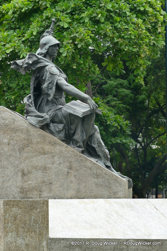
Parque Centenario, Guayaquil
It was here, in the park, where we ran across this rather famous gentleman:

007
Beyond the park is the Church of San Francisco.
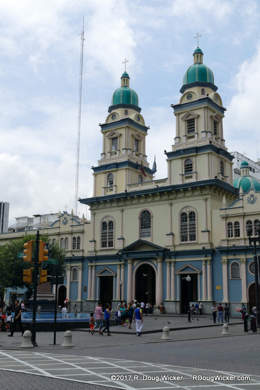
Church of San Francisco, Guayaquil
From the church we turned north for a couple of blocks before once again heading east, which turned out to be rather fortuitous turn because we came across the Bank of Guayaquil. On the side, above the bank’s entrance, was this beautiful mosaic mural:
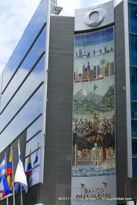
Guayaquil mosaic façade
Close-up images reveal the fine detail of this colorful work:
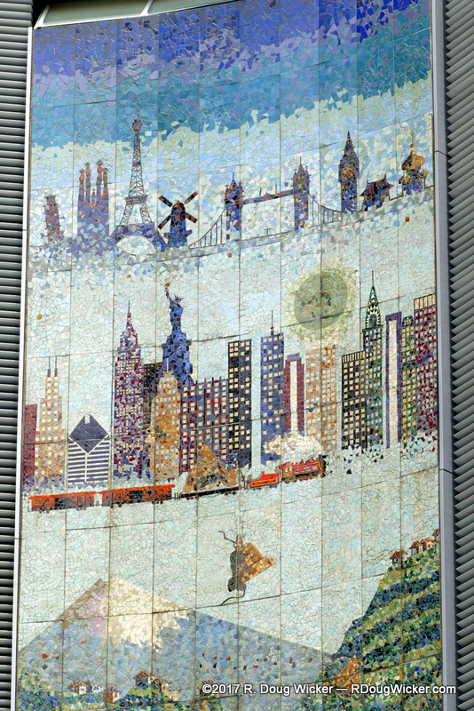
Guayaquil mosaic façade
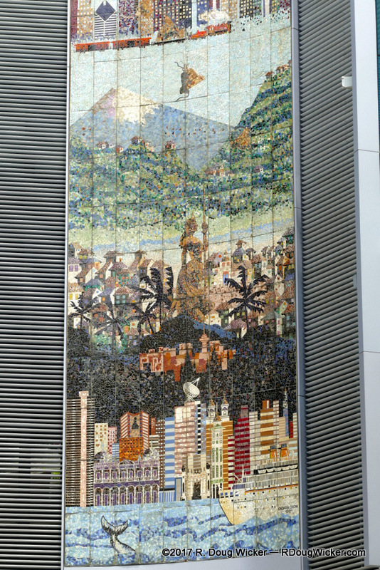
Guayaquil mosaic façade
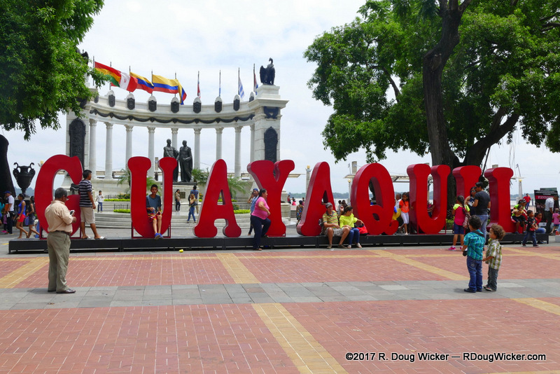
Less than ten minutes later we arrived on foot at the Malecón Simón Bolívar and the rotunda commemorating the meeting between Simón Bolívar and José de San Martín at the Guayaquil Conference of 1822.
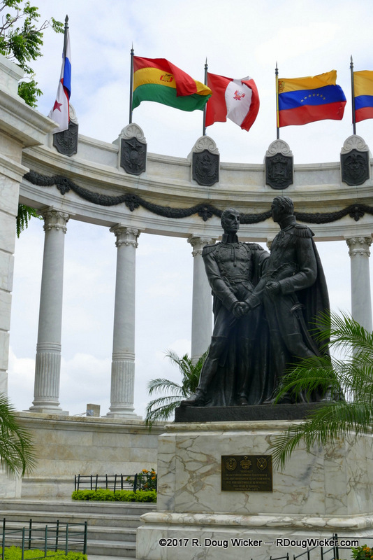
Simón Bolívar and San Martín


 Decisions — Murder in Paradise
 The Globe — Murder in Luxury