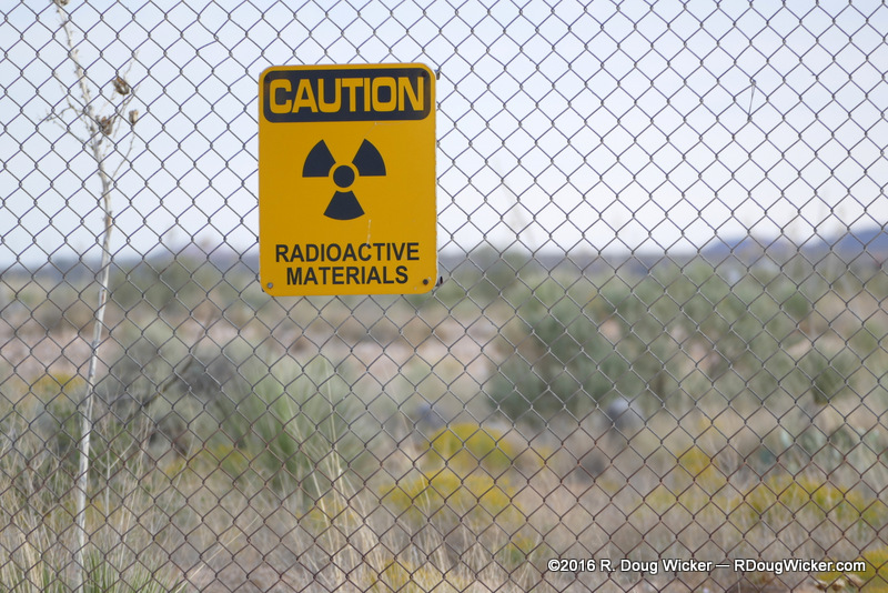
Still radioactive over seventy years later
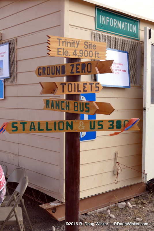
Twice a year there’s an obscure area of scrubland at the north end of the White Sands Missile Range that is opened to the public. Access is tightly controlled. Vehicles are monitored. Guards are posted along the way to direct you. Photography en route to and from this remote site is prohibited. You are about to tour Ground Zero for the world’s first nuclear bomb, a.k.a., “The Gadget“. Welcome to Trinity Site:
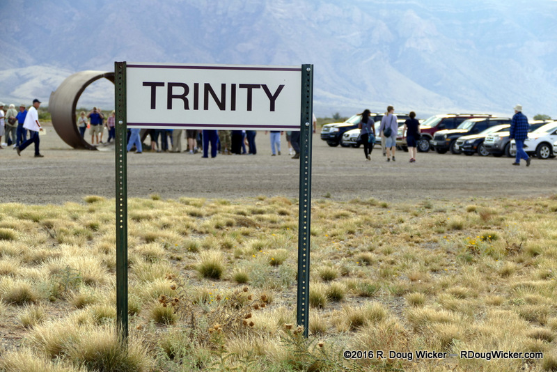
Trinity Site
Trinity is open for public access annually on the first Saturday in April and October. For this year — 2016 — that would be Saturday, April 2 and October 1. The easiest way to get to Trinity is on U.S. Route 380 eastbound off Interstate 25 just south of Socorro, New Mexico, or westbound on U.S. Route 380 from Carrizozo, New Mexico, to the Stallion Gate entrance (12 miles east of San Antonio, NM; 53 miles west of Carrizozo, NM) sometime between the hours of 8:00 A.M. and 2:00 P.M., at which time that entrance is closed. The alternative is to arrive early in the morning at the Tularosa High School before 8:00 A.M. and caravan in to Trinity under escort, which requires another escorted caravan back out from the site at between 12:30 and 1:00 P.M. The site is closed to all visitors at 3:30. As you can see, that makes the unescorted Stallion Gate route the more visitor friendly route. A word of caution: measure the distances I cited from San Antonio or Carrizozo. The entrance is poorly marked and easily missed.
That means YOU!
Starting today and over both this week and next I’ll be showing you not only Trinity Site, but also the McDonald Ranch House where the project scientists stayed, and where the plutonium assembly room for the bomb is located. I’ll also show you trinitite — glass-like, greenish, mildly radioactive fused sand and earth created by the heat of the nuclear explosion.
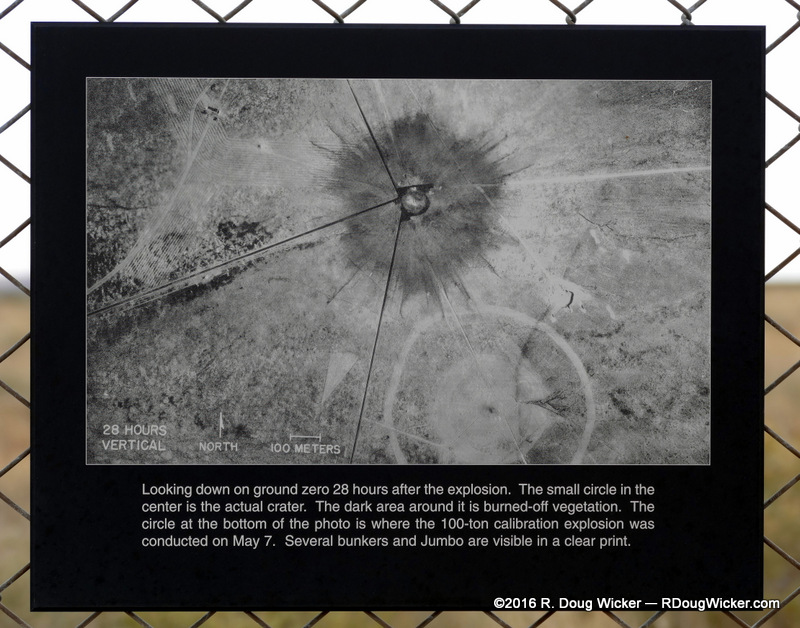
Ground Zero
Today I’m go to show you Jumbo. Jumbo was a gigantic steel container that originally weighed 214 tons/194 metric tons and measured ten feet/three meters wide by 25 feet/7.6 meters long. It’s not that big anymore, and neither does it still weigh 214 tons. It was also much thicker than you see here. This is the six-inch thick inner container. Originally bonded to that were another nine inches of steel plating.

The remains of Jumbo
Jumbo was originally designed as a containment for The Gadget, in case the conventional explosive failed to set off the plutonium core. But as Manhattan Project scientists grew more confident that The Gadget would indeed work, Jumbo was instead suspended from a tower some 2,600 feet/800 meters from Ground Zero just to see what would happen to it. It survived relatively intact, although you wouldn’t know that looking at these pictures. That damage to Jumbo was done two years later when the Army attempted to destroy their $12,000,000 unused container to keep Congress from asking embarrassing questions about the unnecessary expense. Eight 500-pound/227-kilogram bombs were placed inside Jumbo and detonated, but that only succeeded in blowing off the ends.
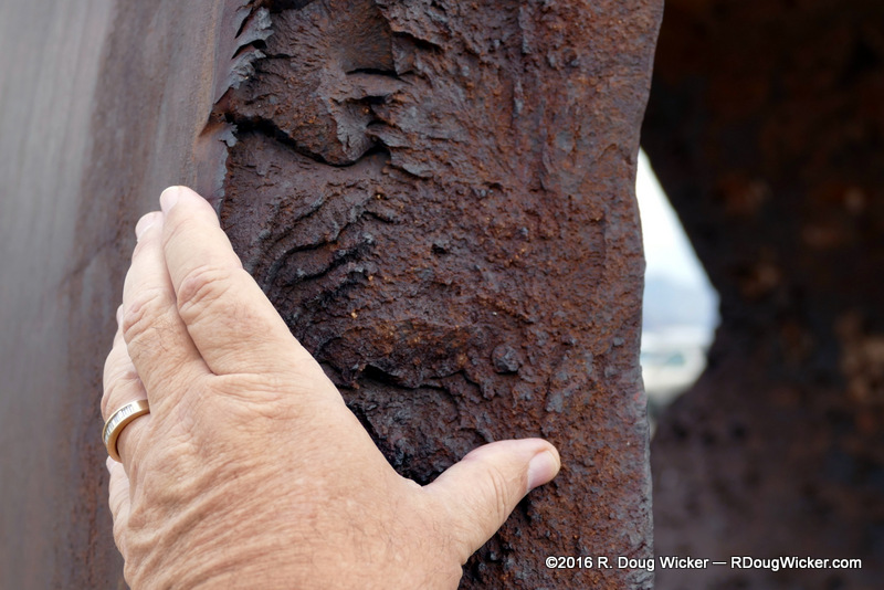
Jumbo’s six-inch thick inner steel wall
We’ll continue our tour on Wednesday. Meanwhile, remember The Twilight Zone?
There’s a Sign Post up ahead; Your Next Stop — The Twilight Zone


 Decisions — Murder in Paradise
 The Globe — Murder in Luxury