El Paso has a pretty cool distinction, as far as U.S. cities go. It’s the only city I know of that is split by a mountain range. I live in West El Paso, which is located on the west side of the Franklin Mountains. Central/Downtown El Paso lies nestled below the southern end of the Franklins, in the pass formed between the Franklin and Juárez Mountains and just a river, a bridge, and a very short stroll away from Ciudad Juárez. East El Paso is where the El Paso International Airport resides (and where I work), as well as Fort Bliss (Army post), Biggs Army Airfield (former Air Force SAC base), and other areas of the city. Northeast El Paso stretches along the eastern slopes of the Franklins.
Wouldn’t be great to see the sights from atop one of the peaks overlooking El Paso and Ciudad Juárez?
You can. And not just by helicopter (which I did aboard an old Huey to the top of Mount Franklin back in the early ’80s). The other ways to get there are to hike or, much less strenuous, by taking a ride aboard the Wyler Aerial Tramway. An aerial tramway, also referred to as a cable car (unless you’re in a San Francisco cable car), consists of a passenger or cargo gondola suspended beneath two cables and pulled by a third cable. They’re not for the height-sensitive queasy types among us, but they get the job done in relatively safe manner . . . unless you’re in one when the military is flying around either in Italy or France.
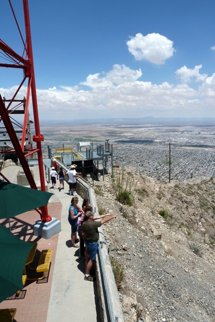
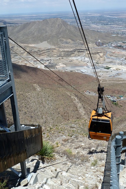
July of last year our eldest grandson came for a visit to Casa de Wicker. So, being one of the aforementioned queasy types, I checked to see if there were any military jets in the air, downed the requisite half-bottle of Scotch (just kidding . . . kinda) and loaded him, Ursula, and myself aboard the tramway, and headed to the top of Ranger Peak some 1,700 feet (518 meters) or so above the surrounding terrain. The actual elevation of Ranger Peak is 5,632 feet above sea level (1,717 meters), but the elevation of the El Paso International Airport (which you’ll be able to see in the distance) is 3,962 feet (1,207 meters).
Tall enough for some fantastic views. From Ranger Peak you can see two cities (El Paso and Ciudad Juárez), three states (Texas, New Mexico, and Chihuahua), and two countries (U.S. and Mexico).
-

-
Wow . . . did you see that UFO, Martha? (Just seeing if you were paying attention)
-
-
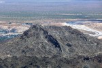
Mount Cristo Rey
-

-
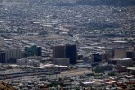
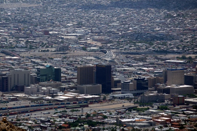
More of downtown
-

-
The Sierra Madres far to the south
-
-
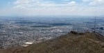
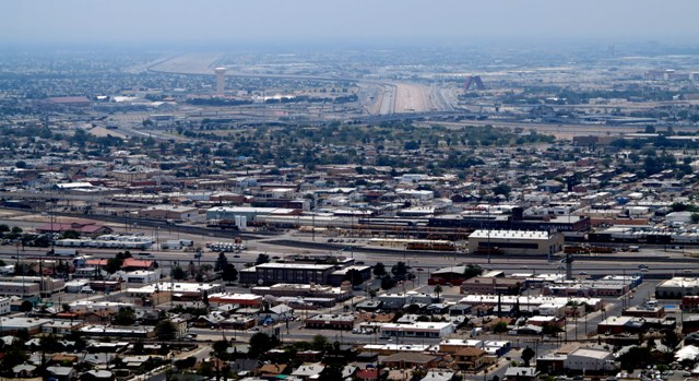
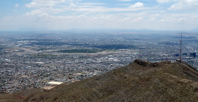
Downtown El Paso, and Ciudad Juárez lies over the bridge
-
-
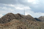
Anntennae Abound Along the Ridgeline
-
-
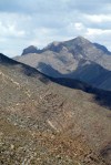
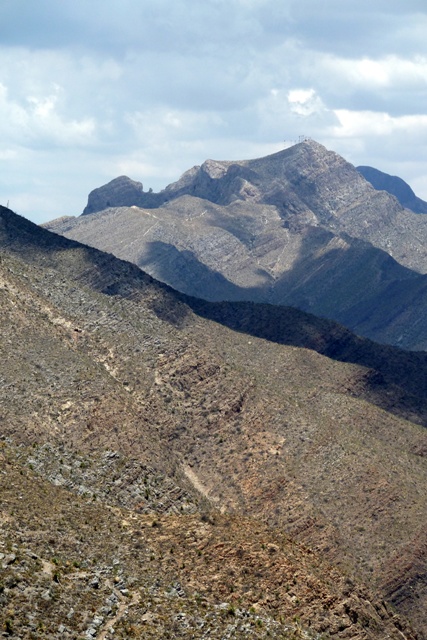
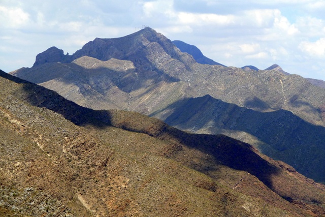
Another view of Mount Franklin
-
-
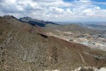
The Franklins and Northeast El Paso
-

-
Mount Franklin stands at 7,100 feet above sea level
-
-
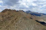
Franklin Mountains to the north
-

-
Juárez Mountains in the background
-
-
A concrete channel separates El Paso from Ciudad Ciudad Juárez, Texas from Chihuahua, and the U.S. from Mexico
-
-
A long way down
-

-
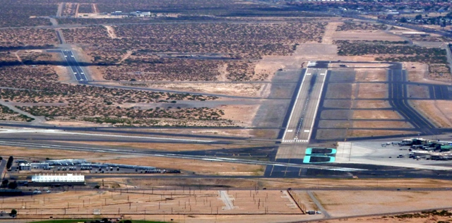
El Paso International Airport—Runways 8 Right and 8 Left clearly visible
-

-
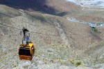
Approaching the top


 Decisions — Murder in Paradise
 The Globe — Murder in Luxury