
El Paso Civil Aviation:
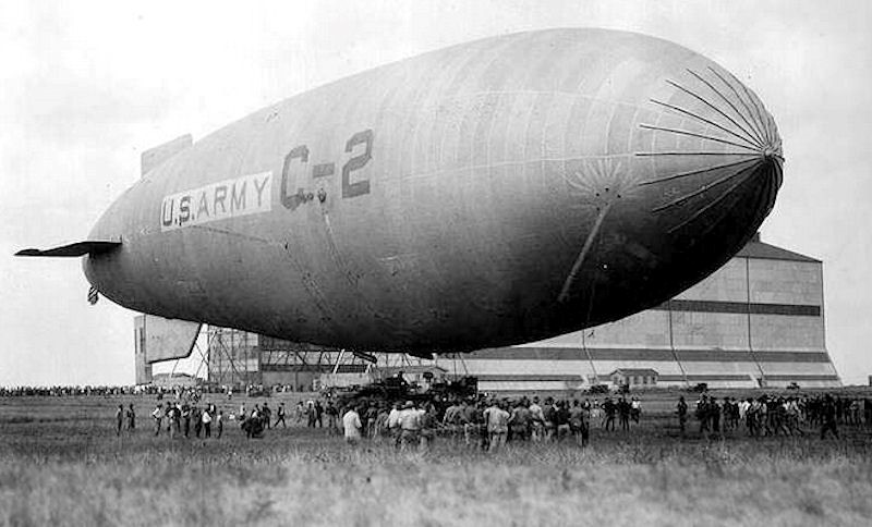
El Paso’s first civilian airfield, El Paso Municipal Airport, was built in 1928 near the eastern base of the Franklin Mountains in the area that today is just northeast of Railroad Drive at Liberty Expressway. Indeed, a road at this location still retains the name Planeport Loop. Operational from 1928 until 1945, El Paso Municipal Airport was managed beginning in 1934 by the newly established Varney Speed Lines, the predecessor of what would eventually become Continental Airlines. On an interesting historical note, in 1926 Walter Varney also started Varney Air Service, which became United Airlines. The fun trivia fact here is that in 2010 Continental and United merged to become United Continental Holdings, thus bringing together under one corporate roof two companies that had the same founder.

Lockheed 2D Vega in Varney Speed Lines/Continental Airlines livery
As for the origin of what is today El Paso International Airport, that began the following year when Standard Air Lines constructed Standard Airport in 1929. Standard Airport thus became the eastern-most destination of Standard Air Lines’ service connecting El Paso, Douglas (Arizona), Tucson, Phoenix and Los Angeles. Standard Air Lines was later sold to Western Air Express, which in turn would eventually merge with Transcontinental Air Transport (T-A-T). Transcontinental Air Transport became Transcontinental & Western Air (T&WA), which eventually rebranded itself as Trans World Airlines (TWA). In between all this, in 1934, Western Air Express separated from T-A-T, and in 1941 Western Air Express became Western Airlines.
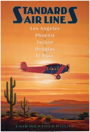
Standard Air Lines poster
So, rather impressively, El Paso aviation played a fundamental role in the establishment of three major airlines — Continental, Western, and TWA. All three have long since merged with other airlines — Western with Delta (1987), TWA with American (2001), and, as previously noted, Continental with United (2010).
How Standard Airport became El Paso International Airport:
In 1936 the city of El Paso relinquished control of El Paso Municipal and gained control of Standard Airport in an exchange of properties requested by the operator of Standard Airport at the time. During World War II the U.S. Army Air Corps took over the former Standard Airport, renaming it El Paso Army Airfield. Thus, both Biggs and El Paso became training fields for heavy bomber crews destined for the conflicts in Europe and the Pacific.
In 1945 El Paso Army Airfield was declared excess, and control of the airport reverted to the city of El Paso.
El Paso International Airport today:
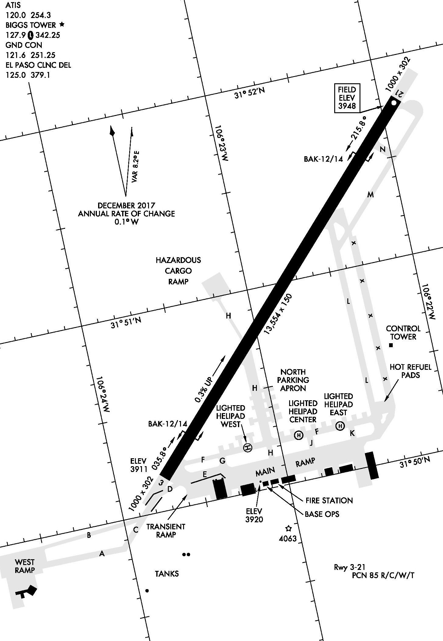
Today, El Paso International Airport controls 7,000 acres/2,833 hectares (10.9 square miles/28.2 square kilometers) of land, much of which is leased to nearby businesses. The airport itself has three runways. Runway 04/22 is 12,020 x 150 feet (3,664 x 46 meters) with an Instrument Landing System (ILS) serving Runway 22, and a Localizer Approach to Runway 04. RNAV approaches also serve both ends of the runway. Runway 8 Right/26 Left is 9,027 x 150 feet (2,751 x 46 meters). Approaches to Runway 26 Left include a VOR approach and two RNAV approaches. Runway 8 Left/26 Right is 5,500 x 75 feet (1,676 x 23 meters), and serves as a reliever runway for smaller aircraft. Runway 26 Right has one RNAV instrument approach.

El Paso International Airport (KELP) diagram
The airspace around El Paso International Airport is highly constrained. The distances below are in statute miles measured from the airport:
- Franklin Mountains rise 3,230 feet/985 meters above the airport just five miles/8 kilometers to the west
- Biggs Army Airfield Runway 03/21 is 1.7 miles/2.7 kilometers northwest of El Paso Runway 04/22
- The international border with Mexico runs 4.5 miles/7.2 kilometers to the south
- The White Sands Missile Range and other military special use airspace are 17 miles/27 kilometers north
- The Hueco Mountains lie about 25 miles/40 kilometers to the east
El Paso Terminal Radar Approach Control (TRACON) airspace reaches from the surface to 17,000 feet above sea level, and stretches from the U.S.-Mexico border to the south to the military ranges north. The airspace to the west ranges out to 25 nautical miles/29 statute miles/46 kilometers, and extends to 35 nautical miles/40 statute miles/65 kilometers east. Within that airspace are four satellite airports served by El Paso TRACON. In addition to the aforementioned Biggs Army Airfield, these airports are Fabens Airport to the southeast, Cielo Dorado Estates Airport (a residential fly-in community) to the west, and Doña Ana County International Jetport Airport also to the west. El Paso TRACON also deals with a major international airport with a control tower and a non-radar approach control facility just south of the international border — the Ciudad Juarez Abraham Gonzalez International Airport.
Friday — El Paso International Airport Today
© 2018 R. Doug Wicker


 Decisions — Murder in Paradise
 The Globe — Murder in Luxury